The second stage of my North Woods & Water Highway adventure took me east from Cold Lake, Alberta, across northern Saskatchewan and into Manitoba.
Travelling in my old Toyota RAV4, I followed Highway 55 through remote farming communities, vast boreal forests, endless canola fields, and some of the quietest roads I have ever driven. For long stretches, it felt as though I had the entire highway to myself.
The journey wasn’t without challenges. Wildfire smoke often hung over the landscape, turning blue skies grey and limiting visibility. At times, I questioned whether I should continue east or abandon the route and head south.
Thankfully, I kept going.
Along the way, I discovered hidden lakes, small prairie towns, unexpected camping spots, and some of the friendliest communities on the Prairies. I spent a night in Nipawin, explored the shores of Candle Lake, followed dusty backroads toward Manitoba, and eventually reached The Pas, gateway to the remote North.
This section of the Northern Woods & Water Highway also includes information for travellers interested in continuing north to Churchill, Manitoba, one of Canada’s most iconic northern destinations.
Why Northern Saskatchewan
The idea for this road trip began several years earlier in the Northwest Territories.
While hiking along the Ingraham Trail near Yellowknife at 10:30 at night under the midnight sun, I met a traveller from Saskatchewan named Stan. As we exchanged road-trip stories, he spoke enthusiastically about the Northern Woods & Water Highway.
By the time we parted ways, the route had earned a permanent place on my bucket list.
Years later, I was finally following that recommendation.
The Northern Woods & Water Highway is the northernmost paved route across Western Canada, stretching from Dawson Creek, British Columbia, all the way to Winnipeg, Manitoba.
What to Expect in This Section?
This stretch of the journey takes travellers through some of Saskatchewan’s lesser-known regions.
Along the way, I visited Meadow Lake, Big River, Prince Albert, Candle Lake, Nipawin, and several lesser-known communities that most travellers pass without noticing.
Like every good road trip, the route was filled with unexpected discoveries and a few surprises.
I certainly didn’t see everything.
That’s one of the reasons I know I’ll be back.
Road Trip at a Glance
Route: Cold Lake, Alberta → Pierceland → Meadow Lake → Big River → Prince Albert → Nipawin → The Pas, Manitoba
After leaving Cold Lake early in the morning, I crossed into Saskatchewan and continued east on Highway 55.
By now, I had travelled many kilometres along the Northern Woods & Water Highway and was still trying to stay ahead of the wildfire smoke drifting across western Canada.
Pierceland was the first Saskatchewan community on my route.
With a population of roughly 600 people, the town felt quiet and unhurried. The streets were nearly empty when I arrived. The visitor information area offers fresh water and a sani-dump station, making it a useful stop for RV travellers heading deeper into northern Saskatchewan.
Side Trips from Pierceland
Travellers with extra time may want to explore:
Pierce Lake, the only lake in Meadow Lake Provincial Park stocked with lake trout.
The Boreal Trail, a 135-kilometre backpacking route and the only year-round backcountry trail in Saskatchewan’s provincial park system.
My overnight stop was the Meadow Lake Community Campground, located behind the local museum.
A sign instructed campers to check in at the museum, but it was already closed when I arrived.
The shower building required an access code. The door happened to be open, but after taking one look inside, I decided that a shower could wait another day.
Not every campground experience becomes a highlight.
Still, I enjoyed my stay. The campground offered shaded tent sites tucked between trees as well as pull-through sites for larger RVs.
The following morning, I left early before the museum opened.
Unfortunately, the wildfire smoke was getting worse.
As I continued east on Highway 55, the landscape disappeared into a grey haze. Travelling through northern Saskatchewan under smoky skies wasn’t nearly as enjoyable as I had imagined.
For the first time on the trip, I seriously considered changing plans.
If conditions remained the same by the time I reached Prince Albert, I thought I might abandon the northern route and head south instead.
3. Green Lake
Only twenty-five minutes east of Meadow Lake lies Green Lake, one of Saskatchewan’s oldest communities.
The North West Company established a trading post here in 1782, followed by the Hudson’s Bay Company in 1799.
Today, the village provides basic services for travellers passing through, including fuel, groceries, and an RV park.
Like many communities along Highway 55, Green Lake serves as a reminder of the region’s long connection to the fur trade and Canada’s northern history.
4. Cowan Dam
A short distance off Highway 55, Cowan Dam Recreation Site offers a peaceful place to stop for the night.
The campground sits beside the river at the north end of Cowan Lake and is popular with local anglers hoping to catch northern pike.
The setting is quiet, scenic, and far removed from the highway, making it an excellent option for travellers looking for a simple overnight stop.
5. Big River
There is a beautiful dock and park at Big River, even with the smoke
By the time I reached Big River, the wildfire smoke was still hanging over northern Saskatchewan, muting the colours of the landscape and giving everything a hazy appearance.
With a population of around 700 people, Big River proudly calls itself the Heart of the Northern Woods & Water Highway.
I drove down to the waterfront at the end of Main Street, where a large picnic area overlooks Cowan Lake. Despite the smoky conditions, it was a peaceful place to stop for a break. Anglers were fishing from the dock, while others simply sat and enjoyed the view.
Like many communities along Highway 55, Big River serves as a gateway to Saskatchewan’s lake country. The town has a regional campground, a small museum, and easy access to hiking trails, fishing lakes, and outdoor recreation.
For travellers crossing northern Saskatchewan, it’s a pleasant place to stretch your legs and slow down for a while.
6. Canwood
Northern PrairiesCanwood
The small village of Canwood sits quietly along Highway 55, surrounded by farmland, forests, and lakes.
With a population of just over 300 residents, it provides basic services for travellers heading east or west across northern Saskatchewan.
Just three kilometres east of town is Canwood Regional Park, a popular destination for camping, golfing, and family recreation. Several excellent fishing lakes are also located within easy driving distance.
Like many small prairie communities, Canwood may not be a major tourist destination, but it offers a glimpse into everyday life in rural Saskatchewan.
7. Shellbrook
Flat, as far as you can see, a typical Northern Saskatchewan Scene
Continuing east, I arrived in Shellbrook, another friendly prairie community surrounded by agricultural land.
Shellbrook is larger than many of the villages along Highway 55 and serves as an important service centre for the surrounding area.
For travellers looking to venture farther north, Shellbrook is also the turnoff to Highway 240, which heads back into the boreal forest and lake country that defines much of northern Saskatchewan.
I didn’t stay long, but it was another reminder of how closely connected farming and wilderness are throughout this region.
8. Prince Albert, the Gateway to the North
Prince Albert is Saskatchewan’s oldest city and is often referred to as the Gateway to the North.
Located along the North Saskatchewan River, the city began as a fur-trading post and grew into an important transportation and service centre for northern Saskatchewan.
After spending days travelling through small towns and quiet countryside, Prince Albert felt busy by comparison.
I wandered through parts of the downtown area, noticing the older brick buildings that reflect the city’s long history. I had hoped to stop at the Visitor Centre, but it was closed when I arrived.
For those interested in local history, the Prince Albert Historical Museum is worth a visit and provides insight into the region’s fur-trading past and pioneer heritage.
I didn’t stay long in Prince Albert. My journey was focused on the quieter roads and smaller communities farther north, so after a short stop, I continued east.
Side Trips from Prince Albert
Prince Albert National Park: About an hour north of the city lies Prince Albert National Park, home to forests, lakes, wildlife, and the resort community of Waskesiu. Although it’s one of Saskatchewan’s most popular summer destinations, I decided to skip it this time. Summer crowds aren’t really my thing.
Candle Lake: Travellers looking for beaches, boating, and lakeside recreation can head northeast to Candle Lake, one of Saskatchewan’s favourite summer destinations.
The Northern Route: For those wanting a more adventurous alternative, Highway 106 provides access to Saskatchewan’s northern Canadian Shield region, with rugged rock formations, clear lakes, and routes toward Flin Flon and northern Manitoba. It’s a completely different landscape from the prairie and farmland scenery found along Highway 55.
Northern Woods and Water Highway – a typical scene
9. Love
I Missed Love
Love may be one of the easiest places in Saskatchewan to miss.
With a population of only about 50 people, I drove right past without realizing it.
Only later did I learn that the village has become famous for its unique “Love” postmark.
Every year, thousands of letters and cards pass through the local post office to receive the special teddy bear cancellation stamp before continuing on their journey around the world.
Had I known, I would have stopped.
After all, how often do you get the chance to tell everyone you’re spending time in Love during a solo road trip across northern Saskatchewan?
Unfortunately, I missed my opportunity.
Perhaps that’s one more reason to return someday.
10. Nipawin
As far as your eyes can see, canola fields
By late afternoon, I rolled into Nipawin, a busy northern Saskatchewan town surrounded by farmland and provincial forests.
My first stop was the local campground. When I learned it would cost $40 for the night, I decided to keep looking.
At a nearby gas station, I asked the attendant if she knew of any good places for free camping.
Her answer surprised me.
She told me she wouldn’t recommend sleeping in my vehicle outside of town and suggested that Tim Hortons would be the safest option. Even after closing, staff would still be around for part of the night.
Before making a decision, I drove around town checking a few alternatives, including the visitor centre parking lot and the Co-op gas station.
In the end, Tim Hortons won.
I parked discreetly behind the building near the drive-through lane, put up my curtains, and settled in for the night.
It turned out to be one of my better urban camping experiences.
The next morning, I treated myself to coffee and a croissant before taking a short walk around town. In daylight, Nipawin felt friendly, active, and welcoming.
The smoke had lifted slightly overnight, revealing blue sky once again.
Before leaving, I stocked up on berries, bananas, and yogurt at No Frills and prepared for the next stage of the journey.
Side Trip to Tobin Lake
About 23 kilometres north of Nipawin lies Tobin Lake, one of Saskatchewan’s premier fishing destinations and a popular spot for catching trophy-sized walleye.
11. The Road to The Pas
On the road from Northern Saskatchewan to The Pas, Manitoba
This was easily one of the most memorable driving days of the entire Northern Woods & Water Highway journey.
The distance between Nipawin and The Pas is only about 209 kilometres, but the road felt much farther.
Initially, Highway 55 passed through farmland and open fields. Gradually, the landscape transitioned into forest.
Then the road began to deteriorate.
Potholes appeared everywhere.
Some had been patched with concrete, while others seemed large enough to swallow a small car. I found myself constantly scanning the pavement ahead and weaving around the worst sections.
Then came the gravel.
Construction zones stretched for kilometres, reducing traffic to single-lane sections and covering everything in dust.
Fortunately, years of driving back roads in British Columbia had prepared me for this kind of adventure.
Traffic was light. For long stretches, I had the road entirely to myself.
Only one large semi-truck passed from the opposite direction, leaving behind a massive cloud of dust that lingered long after it disappeared.
When I finally arrived in The Pas and opened the back of my Toyota RAV4, everything inside was coated in a fine layer of dust.
Road trip life at its finest.
12. The Pas, Manitoba
Old The Pas Courthouse and Sam Waller Museum
The Pas is often called the Gateway to the North, and for many travellers it marks the beginning of Manitoba’s remote northern region.
My first stop was a gas station, where I chatted with a local woman about Churchill, Thompson, and the possibility of seeing polar bears.
I was already dreaming about extending the adventure farther north.
Initially, I considered spending the night near a boat launch east of the Saskatchewan River. When I realized I was on Opaskwayak Cree Nation land, I decided to continue into town instead.
That’s how I discovered Sunrise Park.
Located right along the river, the park offered plenty of parking, walking trails, picnic tables, benches, and beautiful views across the water.
It quickly became my home for the next two nights.
Life at Sunrise Park
From the boat launch, I watched pelicans land gracefully on the river.
A local woman told me the area was “probably safe,” which wasn’t exactly reassuring, but I decided to stay anyway.
The evenings were surprisingly interesting.
Cars arrived and departed throughout the evening. Groups of young people gathered near the waterfront, stayed for a while, and then moved on.
By around 10 p.m., everything became quiet.
The rest of the night passed peacefully.
The following morning, I watched a town employee empty garbage bins before having an unexpected conversation with a homeless man who shared some of his life’s struggles.
Moments like that remind me that every town has stories hidden beneath the surface.
Chief Cornelius Bignell Bridge, connecting The Pas to the Opaskwayak Cree Nation
Exploring The Pas
One of my favourite stops was the Sam Waller Museum, housed in the old courthouse building.
The friendly staff provided useful tips on local attractions and helped me learn more about the area’s fascinating history.
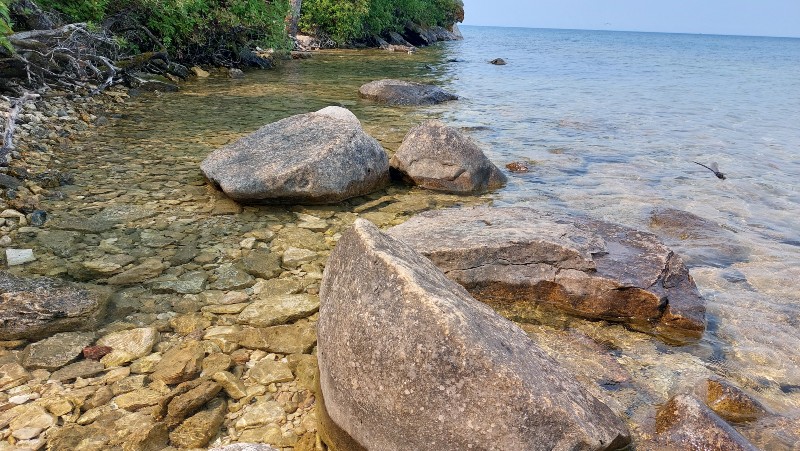
Crystal clear water at Clearwater Lake, Northern Manitoba
If there was one place that completely exceeded my expectations, it was Clearwater Lake.
Located east of The Pas, this spring-fed lake is famous for its incredibly clear turquoise water.
The drive itself is scenic, but nothing prepared me for my first glimpse of the lake.
Even under hazy skies, Clearwater Lake was stunning.
Sunset Beach
Camping at Sunset Beach
I spent the night boondocking at Sunset Beach.
My arrival wasn’t exactly perfect.
Horseflies attacked in swarms.
They covered my vehicle so thoroughly that I ended up spraying the outside of my car with insect repellent.
A strong wind blew across the lake, making it impossible to use my camp stove.
Still, the location was beautiful.
Families filled the beach throughout the afternoon, swimming and enjoying the warm weather. As evening approached, they gradually disappeared until I was left almost alone beside the water.
That’s when Clearwater Lake revealed its magic.
I walked into the lake after everyone had gone home.
The water was crystal clear, the sandy bottom soft beneath my feet, and the evening peaceful and quiet.
It became one of my favourite swimming experiences of the entire trip.
The Caves Self-Guiding Trail
The Caves Trail to a beautiful Peddel Beach
The self-guided loop leads through the forest and along dramatic rock formations overlooking the lake.
Viewing platforms and stairways provide excellent views of giant crevasses formed when the rock split apart thousands of years ago.
The trail itself is easy to follow.
At least that’s what I thought.
Ignoring my own advice, I wandered off the designated route and promptly got lost.
Eventually, I found my way back, but it was a good reminder that even short hiking trails deserve respect.
End of Section 2
The Pas region in Manitoba marked the end of the second portion of this journey and the beginning of the next stage of my adventure south to connect with the Red Coat Trail, the most southern road across the prairies.
Ahead lay …, and many more kilometres of open road.
Churchill Dreams and Future Adventures
The Pas, Manitoba Train Station
One reason I travelled to The Pas was to investigate the possibility of continuing north to Churchill.
My plan was simple.
Drive to Thompson.
Park the RAV4.
Take the train to Churchill.
See polar bears.
Unfortunately, reality had other ideas.
When I tried booking a train ticket, every seat was sold out.
July is peak season, and I learned an important lesson: if Churchill is on your bucket list, book transportation well in advance.
Another place that remains high on my list is Saskatchewan’s remote Athabasca Sand Dunes.
Stretching for approximately 100 kilometres along the southern shore of Lake Athabasca, these massive dunes can only be reached by floatplane.
The logistics require planning, time, and a healthy travel budget.
For now, they remain another northern adventure waiting for the future.
Planning a Trip to Churchill from The Pas
One of the reasons I wanted to visit The Pas was to investigate the possibility of continuing north to Churchill, Manitoba, famous for its polar bears, beluga whales, and northern wilderness.
My original plan was simple:
Drive from The Pas to Thompson.
Park my Toyota RAV4.
Take the train to Churchill.
Spend a few days exploring Canada’s North.
Unfortunately, I discovered too late that all train seats were sold out for my travel dates.
If Churchill is on your bucket list, here are a few things I learned:
Getting to Churchill
There is no road connection to Churchill.
The road network ends at Thompson, Manitoba.
Churchill can only be reached by train or plane.
VIA Rail operates the Winnipeg–Churchill train route.
Travellers can board the train in Winnipeg, The Pas, or Thompson.
During summer, train tickets can sell out weeks or even months in advance.
Driving to Thompson
If you plan to continue north by vehicle, the drive from The Pas to Thompson takes approximately four hours.
Before leaving your vehicle, arrange secure long-term parking.
Flying to Churchill
Another option is to fly directly to Churchill.
When I visited The Pas, I stopped at the local airport to inquire about flights and was directed to contact Calm Air, which operates regular services to Churchill.
My Lesson Learned
I should have booked my train ticket before starting this road trip.
Churchill remains high on my travel bucket list, and one day I’ll return to complete the journey.
Northern Saskatchwan, flat country as far as I can see
Final Thoughts
Northern Saskatchewan surprised me.
I expected long distances, small towns, and endless roads. What I didn’t expect was the sense of space and freedom.
I will always remember the giant canola fields stretching to the horizon, the lonely pioneer cabins standing beside forgotten roads, and the endless lakes hidden among the forests.
This section of the Northern Woods & Water Highway isn’t always easy. Distances are long, services can be limited, and travellers need to plan carefully.
But for those willing to venture north, the rewards are immense.
Clear lakes, quiet roads, unexpected conversations, and a side of the Canadian Prairies that few travellers ever experience.
For me, that’s exactly what makes the journey worthwhile.
But for those willing to venture north, the rewards are immense.
Planning Your Northern Saskatchewan & Manitoba Road Trip
Need accommodation, tours, or transportation for your journey?
Yrene lives in the Okanagan, British Columbia, Canada, and is the founder of BackcountryCanadaTravel.com. She was born in Switzerland, lived and worked on different continents and has travelled the world. Yes, that's me, an Entrepreneur, wilderness nut and animal lover who prefers off-the-beaten-track places. I write about things I love. Mostely.




1 Comment
Margaret
What an epic trip