Most travellers crossing Canada head for the Trans-Canada Highway. I decided to take a different route.
Starting in Dawson Creek, British Columbia, I followed the Northern Woods and Water Highway east through northern Alberta, travelling alone and sleeping in my Toyota RAV4. What I discovered was a side of Canada that many people never see: endless canola fields stretching to the horizon, quiet lakes, historic trading posts, small prairie communities and some of the friendliest people I’ve met on the road.
As a minimalist traveller, I prefer wilderness over cities and back roads over busy tourist attractions. This journey took me through remote landscapes where fuel stations can be far apart, campgrounds fill quickly in summer, and self-reliance is part of the adventure.
This article covers the first section of my road trip along the Northern Woods and Water Highway, from Dawson Creek, British Columbia, to Cold Lake, Alberta. Along the way, I discovered hidden parks, bird sanctuaries, historic sites and unexpected conversations with locals that became some of the highlights of the trip.
Although I began my journey in Vernon, British Columbia, this section starts in Dawson Creek, the official beginning of both the Alaska Highway and the Northern Woods and Water Highway. Stretching all the way to Winnipeg, Manitoba, the Woods and Water Highway is the northernmost paved route across Western Canada.
For me, the real attraction wasn’t just the destination. It was the experience of driving through northern prairie country, watching the landscape change from boreal forest to farmland, passing endless yellow canola fields, and discovering small communities that rarely appear on tourist itineraries.
Road Trip at a Glance
Route: Dawson Creek, BC → Spirit River → Dunvegan → Peace River → McLennan → Slave Lake → Athabasca → Cold Lake
Distance: Approximately 1,000 km (plus side trips)
Travel Style: Solo road trip and car camping}
Vehicle: Toyota RAV4 mini-camper
Best Time to Travel: June to September
Trip Highlights:
Boondocking beside the Pine River
Historic Dunvegan and the Peace River Suspension Bridge
The rolling hills around Peace River
Kimiwan Bird Walk in McLennan
Lesser Slave Lake’s sandy beaches
Small-town Alberta and the people I met along the way
Planning for a Northern Alberta Road Trip
Travelling across northern Alberta requires some preparation. Distances between communities can be considerable, cell coverage is not always reliable, and camping options can be limited during the busy summer season.
If you’re planning a similar journey, take time to research fuel stops, accommodation options and road conditions before leaving. My Road Trip Planner for the Wilderness and Travel Resources pages can help you prepare for a safe and enjoyable adventure.
Car and Campervan Rental in Canada
Book a car or campervan in advance for a reasonable deal, especially during summer. Or travel as a minimalist like me and convert your car into a mini camper if you live in Canada or the US.
1. Dawson Creek, BC: Gateway to the Northern Woods and Water Highway
Start of the Alaska Highway, and the official start of the Northern Woods & Water Highway
Dawson Creek marks the beginning of two legendary routes: the Alaska Highway and the Northern Woods and Water Highway. Located in British Columbia’s Peace Region, this northern community is best known for the famous Mile “0” Post, where travellers begin their journey north to the Yukon and Alaska.
For me, Dawson Creek wasn’t just another stop on the map. It marked the official start of my eastbound adventure across northern Canada.
Before leaving town, it’s worth visiting the Dawson Creek Visitor Centre to pick up maps and local information. Other attractions include the Mile “0” Cairn, the Northern Alberta Railway Park with its historic grain elevator, and the colourful murals scattered throughout downtown.
A Hot Summer Evening at Pine River
Boondocking at the Pine River, west of Dawson Creek
The night before reaching Dawson Creek, I was looking for a place to camp west of town. By pure luck, I ended up at the same boondocking spot beside the Pine River where I had stayed the year before.
My camping app directed me to a turnoff just before the Pine River Bridge. Following a short gravel road, I arrived at a quiet riverside area with several informal camping spots. It felt like a lucky find, especially after a long day of driving.
An older traveller was already parked there with a dog and two beautiful cats. Encounters like this are one of the reasons I enjoy solo road trips. You never know who you’ll meet in these out-of-the-way places.
I set up my Starlink dish and was pleased to find a strong internet connection. The temperature, however, was another story. It was late July, nearly 7 p.m., and still 35°C. I was sweating in the heat and dreaming about cooler weather.
Later, I wandered down to the boat launch and watched local families swimming in the river. Several trucks were parked nearby, but as evening approached, everyone gradually disappeared, leaving the riverbank peaceful and quiet.
I briefly considered going for a swim myself, but after a long day on the road, exhaustion won. Instead, I relaxed beside my vehicle and enjoyed the calm evening.
Unfortunately, the local welcoming committee soon arrived. Blackflies and horseflies descended in force, and I quickly attached bug netting to my car window. Northern summer travel has its rewards, but insects are definitely part of the experience.
The Road into Dawson Creek
The following morning, I continued east toward Dawson Creek. Stewart Lake shimmered beside the highway, and a few kilometres farther on, I passed the old Roadhouse Café, a reminder of the region’s long transportation history.
My first stop was the Dawson Creek Visitor Centre. Ironically, despite expecting to check messages and catch up online, there was no internet service available that morning.
Sometimes road travel doesn’t go exactly as planned—and that’s all part of the adventure.
2. Moonshine Lake Provincial Park
Breakfast at Moonshine Lake during a northern Alberta heat wave.
After leaving Dawson Creek, I followed Highway 49 east into Alberta. About 32 kilometres before Spirit River, I turned off onto a dusty side road leading to Moonshine Lake Provincial Park.
The park was quiet and beautifully maintained, with picnic tables, an outhouse, neatly cut grass and excellent opportunities for birdwatching. It seemed like the perfect place to stop for breakfast.
I pulled out my single-burner stove and boiled water for coffee and tea while mixing together some muesli. Travelling through northern Alberta during a heat wave was beginning to create problems. The soy milk I had been carrying was starting to ferment, and my oranges were becoming soft and slightly rotten.
As I sat beside the lake, I couldn’t help thinking that perhaps it was finally time to invest in a small car refrigerator.
After breakfast, I wandered along the shoreline, photographing unfamiliar berry bushes that looked like red currants or perhaps soapberries. By then, I was developing a headache, probably from the heat. I had little appetite but forced myself to eat something before continuing the journey.
Back on Highway 49
Returning to the highway, I crossed into Alberta. Unfortunately, there was no safe place to pull over and photograph the “Welcome to Alberta” sign.
Traffic was light, mostly trucks. The road stretched ahead through open country as I passed the turnoff to Blueberry Mountain and continued toward Spirit River.
3. Spirit River: Unexpected Conversations
Entrance to the Spirit River Museum grounds
I arrived in Spirit River looking for fuel, only to discover that the town’s gas station had burned down.
Instead of finding gas, I found something much more memorable.
A short drive brought me to the Spirit River Museum grounds, one of those hidden places that rarely appear in guidebooks. The museum caretaker handed me a key and invited me to explore the historic buildings at my own pace.
As I was leaving the small church, I met Bill.
Despite a broken arm and difficulty walking, Bill enthusiastically shared stories about his life, including a recent trip to the Netherlands and memories of growing up during the Second World War. What started as a brief conversation turned into one of those encounters that solo travellers treasure.
You never know what you’ll discover in small northern towns. Sometimes the highlight isn’t a historic site or scenic viewpoint. It’s the people.
Eventually, I continued east, finding fuel near the Dunvegan Flats corner. The landscape had changed noticeably. Hay bales dotted the fields, oil pumps worked steadily in the distance, and large farmyards with silos and storage tanks became part of the scenery.
4. Dunvegan
The Dunvegan Suspension Bridge crossing the Peace River.
Historic Dunvegan had been on my bucket list for years.
Although I had driven this route several times, I had always continued past without stopping. This time, I finally took the opportunity to explore Alberta’s oldest settlement and cross the famous Dunvegan Suspension Bridge, the only suspension bridge in Alberta open to vehicle traffic.
The visitor centre was less interesting than I had expected, but the historic trading post more than made up for it. I enjoyed wandering through the riverside parkland overlooking the Peace River and imagining what life must have been like here during the fur trade era.
Dunvegan Provincial Park offers camping on the north side of the bridge and would make an excellent overnight stop for travellers exploring the region.
While walking through another section of the park, I discovered a large First Nations cemetery beside a private campground. The quiet setting added another layer of history to a place already rich in stories.
One attraction I missed was the famous Dunvegan Gardens. I’ll have to save that for another visit.
5. Fairview
Fairview, a small community in Northern Alberta
Continuing east on Highway 2, I arrived in Fairview, a small community overlooking the Peace River region.
The area is known for its rolling countryside and impressive views of the Peace River Valley. Golfers may want to visit the local golf course, while campers can find a peaceful overnight stop at nearby Cummings Lake Campground.
For me, Fairview was a pleasant stop before continuing deeper into northern Alberta.
6. Grimshaw and the Endless Canola Fields
Typical Grain Elevator sight, found all across the prairies.
Grimshaw marks Mile Zero of the Mackenzie Highway (Highway 35), a route that stretches approximately 600 kilometres north toward the Northwest Territories. For many travellers, it is the gateway to Canada’s North.
By this point in my journey, the landscape had become a sea of yellow. Some of the largest canola fields I had ever seen stretched to the horizon, alternating with hayfields and the occasional grain elevator rising above the prairie. The scale of northern Alberta surprised me. Distances felt bigger, the skies wider, and the roads quieter.
Travellers looking for camping options will find several campgrounds in and around Grimshaw, including nearby Queen Elizabeth Provincial Park and Lac Cardinal, both worth considering for a break from the road.
Wilderness Park: An Unexpected Find
Stopping at another one of Alberta’s hidden treasures
A few kilometres east of Grimshaw, I turned off Highway 2 and followed a short road to Wilderness Park.
This hidden gem was one of those unexpected discoveries that make road trips memorable.
The peaceful day-use area featured picnic tables, fire pits, walking trails, and several small ponds stocked with rainbow trout and grayling. Surrounded by wetlands and forest, it felt far removed from the highway despite being only minutes away.
I wandered around the ponds, enjoying the quiet and watching for birds and wildlife. It was the perfect place to stretch my legs before continuing east through the Peace Country.
7. Peace River
Twenty minutes east of Grimshaw, the landscape suddenly changed.
Rolling hills appeared, and the road descended toward the Peace River Valley. After hours of driving through relatively flat country, the scenery felt dramatic and unexpected.
My first impression of Peace River was overwhelmingly positive. The town felt welcoming and prosperous. The homes were well cared for, the streets tidy, and the surrounding countryside absolutely beautiful. It was one of those places that immediately made me want to stay longer and explore.
Exploring the Peace River Valley
The Peace River region offers plenty of opportunities for outdoor adventure. One of the best viewpoints is Misery Mountain, which provides sweeping views over the town, river valley, and surrounding farmland.
Another favourite attraction is the Peace River Suspension Bridge. Walking across the river gives you a completely different perspective of the valley and a chance to appreciate the size of the Peace River.
For travellers interested in hiking, birdwatching, stargazing, or viewing the northern lights, Peace River makes an excellent base for several days of exploration.
Scenic Detour: The Shaftesbury Trail
One route I highly recommend is the Shaftesbury Trail.
Following the Peace River for approximately 26 kilometres, this scenic drive winds through some of the most beautiful countryside in the region. Whether approached from Grimshaw or Peace River, the route offers spectacular views of the river valley, farmland, and rolling hills.
At the end of the trail, travellers can cross the Peace River on the free Shaftesbury Ferry. Watching the river flow past while standing on the ferry deck is an experience worth slowing down for.
Tangent Park Campground
Located on the east side of the river near the ferry crossing, Tangent Park Campground offers serviced campsites, showers, group camping facilities, and horseback riding trails.
Even if you don’t stay overnight, the area is worth visiting for its peaceful riverside setting.
Back on Highway 2
Leaving Peace River behind, I climbed out of the valley on a modern highway with stunning views over the Peace Country.
Signs pointed toward Peace River Provincial Recreation Area and Greene Valley Provincial Park. Beyond them lay more farmland, more canola fields, and the small community of Nampa, where I took a short detour through quiet residential streets and noticed a small neighbourhood park before continuing on.
8. Donnelly
Artistic paintings on the back of street signs
The road to Donnelly passed between vast canola fields and large industrial tanks. Signs for the Peace River Oilsands appeared along the route, reminding me that agriculture isn’t the only industry shaping this region.
When I arrived in Donnelly, I parked and set out on foot.
With a population of only a few hundred people, the town felt remarkably quiet. The wide streets were almost empty. I walked past the post office and noticed a massive cell tower rising behind it.
The most interesting feature of Donnelly was its collection of hand-painted street signs. Local artists had transformed the backs of ordinary traffic signs into colourful works of art, giving the town a unique character.
Unfortunately, many of the paintings had faded with time and were beginning to show their age. Even so, they remained one of the most memorable public art projects I encountered on the trip.
As I wandered through town, I couldn’t help wondering:
Where is everyone?
The silence felt almost surreal.
9. McLennan – Bird Capital of Canada
Kimiwan Birdwalk at Mc Lennon, the Bird Capital of Canada
McLennan turned out to be one of the highlights of my northern Alberta road trip.
Known as the Bird Capital of Canada, this small Peace Region community is famous among birdwatchers for its proximity to Kimiwan Lake, one of the premier waterfowl viewing areas in North America.
The town also offers a convenient self-registration campground near Kimiwan Lake, making it an excellent stop for travellers exploring the region.
Watch the waterfowl at the Kimiwan Bird Walk
Kimiwan Boardwalk
The Kimiwan Bird Walk was everything I had hoped it would be.
After stopping at the interpretive centre to learn more about the area’s wildlife, I followed the self-guided trail through wetlands toward the boardwalk extending over the shallow waters of Kimiwan Lake.
Birds seemed to be everywhere.
Waterfowl landed on the railings only a few metres away. Their calls echoed across the marsh, while others drifted silently across the water. The combination of wetlands, open water, and abundant wildlife created a peaceful atmosphere unlike anywhere else on the trip.
What I expected to be a short stop turned into more than an hour of wandering, watching birds, and simply enjoying the experience.
For anyone travelling through northern Alberta, this is a place not to miss.
It felt like a little piece of wilderness paradise hidden in the middle of the Prairies.
10. High Prairie
Huge Canola Fields, as far as my eyes can see
Leaving McLennan behind, Highway 2 continued south through what seemed like endless fields of canola. Brilliant yellow stretched to the horizon on both sides of the road, broken only by grain elevators, farmyards, and the occasional stand of trees.
By now I had entered Big Lakes County, one of Alberta’s largest agricultural regions. The open road was quiet, and for long stretches it felt as though I had the highway entirely to myself.
High Prairie is a small service centre at the junction of Highways 2 and 749. Travellers interested in local history may want to visit the High Prairie & District Museum, while several restaurants offer a welcome break from the road.
11. Faust
St. Paul Church
By late afternoon I arrived in the tiny hamlet of Faust on the shores of Lesser Slave Lake.
My original reason for stopping was simple: I wanted a photograph of St. Paul’s Church. After taking a few pictures, I drove down to the lakeshore and found a pleasant marina, a campground, and a boat launch overlooking the lake.
The next turnoff led to Kinuso, a First Nations community. Under different circumstances, I might have explored further, but after a long day on the road, I decided to save that adventure for another time.
Sometimes, road trips are as much about the places you don’t visit as the ones you do.
12. Slave Lake
The idyllic Beaches of Northern Alberta
Slave Lake felt busy after spending days in small communities.
The shopping areas around Walmart and the major stores were bustling with activity, and I needed to find a place to spend the night. Unfortunately, the Walmart parking lot was under construction and already full.
Eventually, I found a quiet, shaded spot near Sobeys and Canadian Tire.
I rarely spend the night in parking lots, but they can be useful when arriving late in the day. My approach is simple: stay discreet, don’t set up camp, and leave early the next morning.
The large RVs that spread out chairs, awnings, and barbecue equipment are one reason many businesses have begun posting “No Overnight Camping” signs. I prefer to be respectful and keep a low profile.
Devonshire Beach and Lesser Slave Lake
Devonshire Beach on Lesser Slave Lake, Northern Alberta
The following day, I drove north along Highway 88 toward Lesser Slave Lake Provincial Park.
Lesser Slave Lake is enormous. Standing on the shore, the opposite side appears only as a faint shadow on the horizon.
Instead of entering the main provincial park area, I explored some of the side roads along the shoreline and eventually found access to Devonshire Beach.
A wooden boardwalk led through the dunes to a beautiful stretch of soft sand. Families were swimming, children were playing in the water, and people were relaxing in the summer sun.
The beach felt surprisingly tropical for northern Alberta.
I spent some time walking along the shoreline and taking in the view before continuing my journey.
Later, I discovered that part of the route follows the Trans Canada Trail along the lake. Looking back, that was likely the trail I had been exploring.
Typical scenery in Northern Alberta across the prairies
Northern Alberta, what I learned so far
After several days on the road, I was beginning to understand northern Alberta a little better.
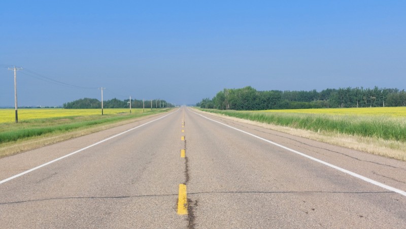
One thing that surprised me was the sheer scale of the landscape. Much of the driving involved long, straight highways cutting through farmland, forest, and wetlands. There were no mountains to dominate the horizon, yet the scenery never felt boring. The endless fields of yellow canola, the vast skies, and the feeling of driving toward an invisible horizon created a beauty all their own.
Camping proved more challenging than I expected.
Many provincial campgrounds were occupied by large RVs, and reservations were often required during the summer season. Free camping opportunities were limited compared to British Columbia, where recreation sites are common.
If I were planning the trip again, I would rely more on regional parks and smaller community campgrounds, many of which turned out to be excellent alternatives.
13. Athabasca
The valley is in smoke from the forest fires in the north
Athabasca sits on the banks of the Athabasca River and traces its roots back to a Hudson’s Bay Company post established in 1874.
When I arrived, smoke from forest fires farther north hung over the valley, softening the landscape and limiting visibility.
Despite the haze, I enjoyed exploring the town.
I parked near the river, spent some time walking through the park, and wandered around the downtown area. The Athabasca River looked ideal for canoeing, boating, or simply spending a quiet afternoon along the water.
One thing I noticed immediately was the fuel price.
Gasoline was considerably cheaper than what I was used to paying in British Columbia.
14. Grassland
Grassland is little more than a roadside hamlet, but it serves as an important stop for travellers heading north toward Fort McMurray.
The thick wildfire smoke gave the community a muted, almost colourless appearance.
As I continued driving, I found myself thinking about the vast northern wilderness beyond Fort McMurray, including Fort Chipewyan and Wood Buffalo National Park, places I hope to explore one day.
15. Lac La Biche
Lac La Biche, the Gateway to Provincial Parks
Lac La Biche is one of Alberta’s oldest communities, with roots reaching back to the fur trade era.
I spent some time wandering through town, admiring the historic storefronts and learning about the area’s history. The community began as a Hudson’s Bay Company post in 1799 and remains one of Alberta’s oldest permanent settlements.
Both offer excellent opportunities to learn more about the region’s history and natural beauty.
16. Cold Lake
The final stretch from Lac La Biche to Cold Lake covered 148 kilometres through forests, lakes, and farming country.
By the time I arrived, I had become accustomed to small towns and quiet highways. Suddenly finding myself surrounded by traffic, busy streets, and shopping centres took some adjustment.
In fact, I immediately got lost and somehow ended up on a gravel road heading toward Cold Lake First Nations before finally finding my way back to town.
Driving along the shoreline later that day, I was impressed by the large homes overlooking the lake. Alberta’s resource wealth was certainly on display.
Yet what appealed to me most wasn’t the development. It was the combination of water, forest, and open space. Cold Lake felt like a place where I could easily spend several days exploring.
Cold Lake marked the end of the Alberta portion of this journey and the beginning of the next stage of my adventure along the Northern Woods and Water Highway.
Ahead lay Saskatchewan, Manitoba, and many more kilometres of open road.
Fuel stations can be far apart in some areas. Top up your tank regularly.
Allow time for unexpected stops. Some of the most memorable experiences on this trip came from places I hadn’t planned to visit.
Slow down and enjoy the journey. The real beauty of northern Alberta is found in the small communities, hidden parks, and chance encounters along the way.
Final Thoughts
The Northern Woods and Water Highway from Dawson Creek to Cold Lake offers a side of western Canada that many travellers never see.
It’s a journey through vast landscapes, quiet communities, rich history, and unexpected discoveries. Whether you’re travelling by car, campervan, motorcycle, or RV, this route rewards those who are willing to leave the main highways behind and explore Canada’s lesser-known North.
For me, the memories that remain strongest aren’t the attractions or the landmarks. They’re the conversations, the hidden places, the endless canola fields, and the feeling of freedom that comes from following an open road into the horizon.
Yrene lives in the Okanagan, British Columbia, Canada, and is the founder of BackcountryCanadaTravel.com. She was born in Switzerland, lived and worked on different continents and has travelled the world. Yes, that's me, an Entrepreneur, wilderness nut and animal lover who prefers off-the-beaten-track places. I write about things I love. Mostely.
2 Comments
Margaret
Nice travels with you…
Yrene Dee
Thanks Margaret! Hopefully you will join me again sometime.




2 Comments
Margaret
Nice travels with you…
Yrene Dee
Thanks Margaret! Hopefully you will join me again sometime.